PHOTO
THE State Government has flagged areas within the Strathbogie Shire as suitable for investigation as future renewable energy zones.
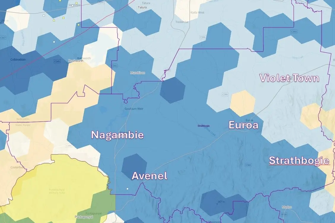
VicGrid, a body within DEECA, has provided The Euroa Gazette with a map showing the investigation priorities assigned to areas in the shire.
Large sections, including in Nagambie, Euroa, Avenel and Strathbogie, are marked in blue, indicating they are “suitable for investigation”, a moderate priority.
Three small sections near Avenel, Goulburn Weir and Dropmore are marked dark blue, indicating “most suitable for investigation” – the highest priority.
Most of Violet Town appears to be marked light blue, indicating “available for investigation” – the lowest priority.
Other areas are marked light grey for “avoidance” (to be avoided) or beige for “deprioritised”, including a large area west of Nagambie.
VicGrid CEO Alistair Parker said: "The study area map is the first step in the consultation process that will occur over the next 12 months.”
“The initial study area will be narrowed down to much smaller areas as we work to define future renewable energy zones,” he said.
Consultation on the initial study area is open until September 30.
VicGrid said the land eventually proposed for renewable energy zones needs to protect significant areas and sites, minimise impacts on land, communities, water, and biodiversity, and keep the total cost of infrastructure low.
They stressed that just because an area is highlighted for further investigation on the map does not mean wind and solar farms and transmission will end up being built there.
VicGrid is calling for the input of regional communities, farmers, landholders, and First Peoples.
An image of the map provided by VicGrid is available on The Euroa Gazette’s website.
VicGrid said an interactive map featuring additional detail will be published on their website.