PHOTO
A NEW Fire Danger Rating System (FDRS) set to come into effect tomorrow will simplify decision–making for households and provide a more accurate appraisal of conditions in the local area.
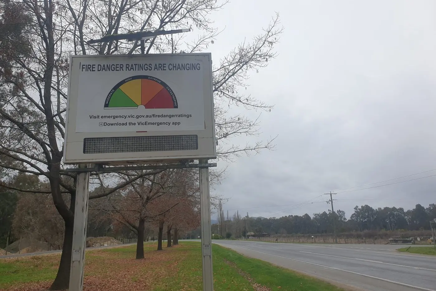
The refined four–tier system will replace the six–tier warning system previously visible along roadsides and online through the CFA website from September 1.
New ratings of moderate, high, extreme and catastrophic fire danger are designed to create a clearer approach to managing fire danger and risk, with clear and concise instructions for each escalation, such as:
• Moderate – plan and prepare;
• High – be ready to act;
• Extreme – take action now to protect life and property; and
• Catastrophic – for your survival, leave bushfire risk areas.
CFA state deputy chief officer Alen Slijepcevic said the new nation–wide system would unify key safety messaging and could provide a detailed synopsis of anticipated fire behaviour tailored to regions within a fire district.
"Agencies provide information on fuel hazards across the landscape and terrain and the Bureau of Meteorology (BoM) inputs their modelling on what the weather will be like over the next one to seven days," he said.
"We went from the existing two fire danger models for forest and grassfires to eight across the state – but not all of them are applicable to Victoria.
"There are always differences based on the fuel type and the weather – if we're in the Mallee, we will use the Mallee fire behaviour model, if we're in the hinterlands we can use the hinterlands model.
"The new national system is truly national, so as people move across the borders between the jurisdictions they will see the same signs with the same categories and hear the same messaging of what the actions the communities need to undertake are, and that will help quite significantly."
Mr Slijepcevic said CFA officials would utilise a four indices system which would dictate a township's fire danger rating, taking into account the probability of a fire staring, its potential behaviour, the chance of the fire being suppressed in specific conditions and then modelling potential damage a blaze could cause.
He said climatological data accumulated during the upcoming fire season could be used to lead a review of existing fire weather districts ahead of the 2023/24 summer.
"This year we are running with the existing fire weather districts but we'll do the reanalysis of the climatological data sets and it's likely to change so we might group things based more on local government areas (LGAs) that are more similar in their climatological data sets," he said.
"As we develop the system it will become even more sophisticated – the public displays (of fire danger ratings) will not change but we will have a more sophisticated decision–making engine behind it."
All existing automatic and the majority of the state's 380 manual fire danger signs are set to be replaced by December 1, with the North East anticipated to record another summer free of significant bushfire threat.
"As we're going through the replacement we'll be making sure they are in appropriate locations and it is reasonably safe for volunteers to change those signs – we'll progressively replace them based on the fire danger periods," Mr Slijepcevic said.
"Having a third La Niña in a row, it is likely that we will have a very similar fire season, likely to be dominated by grass and crop fires rather than forests.
"The North East and Gippsland forests are pretty saturated which from the fire perspective is a good position to be in, especially when we're going through a significant change like this one."
For more information about fire danger ratings, visit https://www.cfa.vic.gov.au/warnings–restrictions/total–fire–bans–and–ratings/about–fire–danger–ratings.